COLLECTION NAME:
Japanese Historical Maps
Record
Author:
Itō, Son'ichirō
Date:
1877
Short Title:
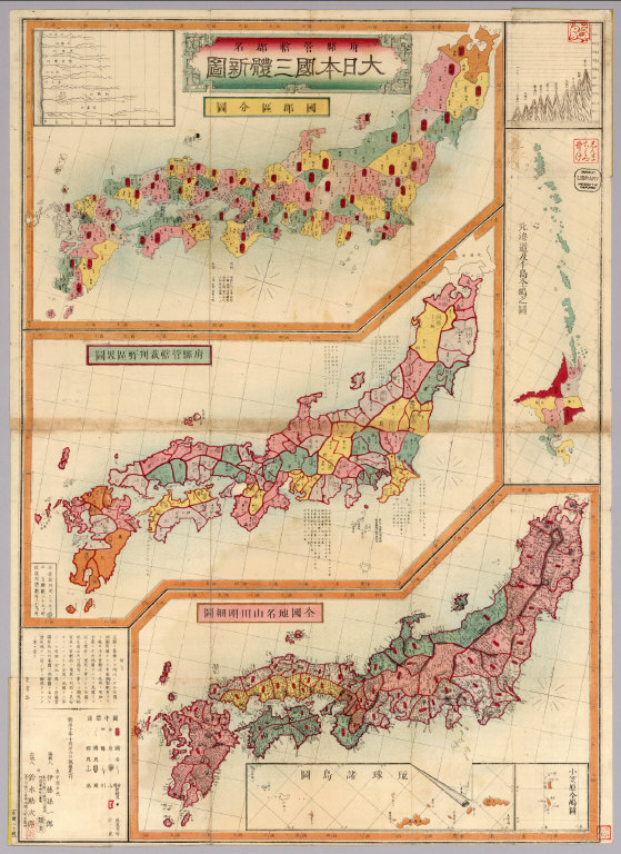
Fuken kankatsu gunmei Dai Nihonkoku santai shinzu.
Publisher:
[Tokyo]: Suzuki Kanjirō
Type:
Pocket Map
Obj Height cm:
79
Obj Width cm:
51
Scale 1:
No scale given
Note:
Japanese date Meiji 10 [1877]. In color. Folded. 3 maps on one sheet.Copperplate print. In Japanese. Oriented with north to the upper right. Relief shown by hachures. Contents: Kokugun kubunzu ; Fuken kankatsu saibansho kukaizu ; Zenkoku chimei sansen meisaizu. 2 insets: Ryūkyū Shotō zu ; Ogasawara zentō zu. 1 ancillary map: Hokkaidō oyobi Chishima Zentō zu. Includes charts of mountains and rivers , preface and legend.
Country:
Japan
Full Title:
Fuken kankatsu gunmei Dai Nihonkoku santai shinzu.
List No:
Cb56
Series No:
2
Publication Author:
Itō, Son'ichirō
Pub Date:
1877
Pub Title:
Fuken kankatsu gunmei Dai Nihonkoku santai shinzu.
Pub Note:
See Note field above.
Pub List No:
Cb56
Pub Type:
Pocket Map
Pub Maps:
1
Pub Height cm:
14
Pub Width cm:
9
Image No:
Cb56
Fuken kankatsu gunmei Dai Nihonkoku santai shinzu.
