COLLECTION NAME:
Japanese Historical Maps
mediaCollectionId
RUMSEY~9~1
Japanese Historical Maps
Collection
true
Date:
1687
date
1687
Date
false
Short Title:
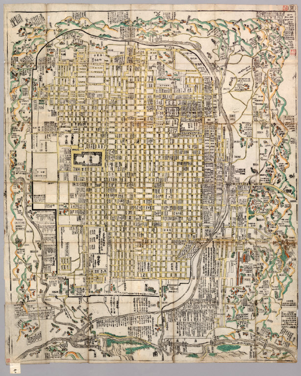
Kyō ezu.
short_title
Kyō ezu.
Short Title
false
Publisher:
Not given
publisher
Not given
Publisher
false
Type:
Case Map
type
Case Map
Type
false
Obj Height cm:
128
obj_height_cm
128
Obj Height cm
false
Obj Width cm:
103
obj_width_cm
103
Obj Width cm
false
Scale 1:
No scale given.
scale_1
No scale given.
Scale 1
false
Note:
Japanese date Jokyo 4 [1687] estimated. In color. Folded. Wood block print. In Japanese. Title added by hand. Relief shown pictorially. Includes distance chart and index
note
Japanese date Jokyo 4 [1687] estimated. In color. Folded. Wood block print. In Japanese. Title added by hand. Relief shown pictorially. Includes distance chart and index
Note
false
Country:
Japan
country
Japan
Country
false
City:
Kyoto (Japan)
city
Kyoto (Japan)
City
false
Full Title:
Kyō ezu.
full_title
Kyō ezu.
Full Title
false
List No:
F2
list_no
F2
List No
false
Series No:
2
series_no
2
Series No
false
Pub Date:
1687
pub_date
1687
Pub Date
false
Pub Title:
Kyō ezu.
pub_title
Kyō ezu.
Pub Title
false
Pub Note:
See Note field above.
pub_note
See Note field above.
Pub Note
false
Pub List No:
F2
pub_list_no
F2
Pub List No
false
Pub Type:
Case Map
pub_type
Case Map
Pub Type
false
Pub Maps:
1
pub_maps
1
Pub Maps
false
Pub Height cm:
23
pub_height_cm
23
Pub Height cm
false
Pub Width cm:
16
pub_width_cm
16
Pub Width cm
false
Image No:
F2
image_no
F2
Image No
false