COLLECTION NAME:
Japanese Historical Maps
Record
Author:
Watanabe, Tomio
Date:
1901
Short Title:
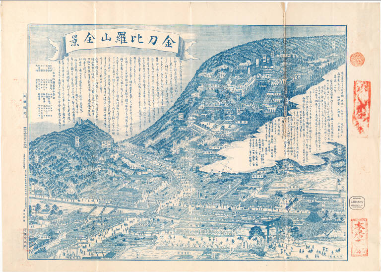
Kotohirasan zenkei / Watanabe Tomio.
Publisher:
Kagawa-ken Nakatado-gun Kotohira-cho
Type:
Pocket Map
Obj Height cm:
34
Obj Width cm:
46
Scale 1:
None shown
Note:
Folded to 20 x 14 cm. In Japanese. Oriented with north to the lower right. Bird's-eye view. Includes historical text, distance chart and festival calendar. East Asian Library call number Hb33.1.
Country:
Japan
State/Province:
Kagawa-ken (Japan)
City:
Kotohiragu (Kotohira-cho, Japan)
Full Title:
Kotohirasan zenkei / Watanabe Tomio. Meiji 34 [1901]
List No:
Hb33.1
Series No:
1
Publication Author:
Watanabe, Tomio
Pub Date:
1901
Pub Title:
Kotohirasan zenkei / Watanabe Tomio. Meiji 34 [1901]
Pub Note:
See note field above.
Pub List No:
Hb33.1
Pub Type:
Pocket Map
Pub Height cm:
34
Pub Width cm:
46
Image No:
jhm000505a
Kotohirasan zenkei / Watanabe Tomio.